


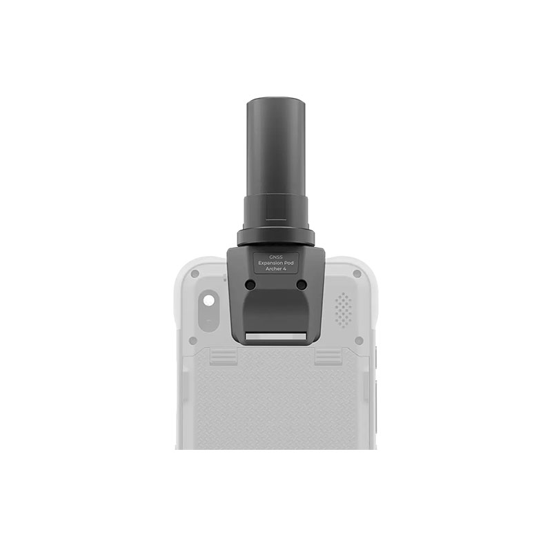


Juniper Archer 4 GNSS Pod

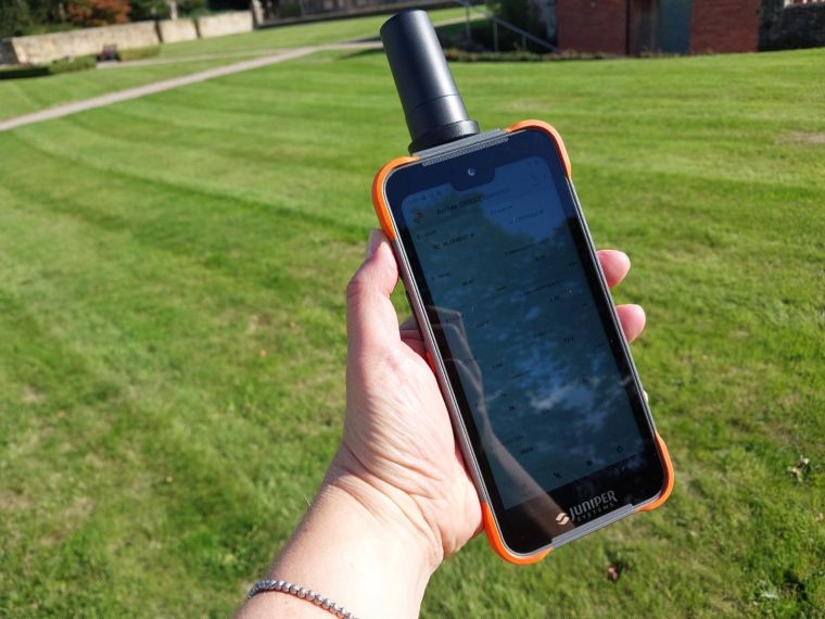
With the GNSS Expansion Pod, the Archer 4 becomes an essential mapping tool. The lightweight design and one-handed operation are ideal for remote field mapping.
ACCURACY
Meter to Centimeter
COMPATIBILITY
Archer 4 only
BATTERY
All-day power
DESIGN
One-handed operation
- Description
Description
The A4 GNSS Expansion Pod is a precision GNSS enhancement accessory for the Juniper Systems Archer 4 rugged handheld. When attached, the pod transforms the handheld into a capable GNSS receiver that supports real-time kinematic (RTK) corrections. This enables field professionals to collect accurate spatial data down to centimeter-level precision when connected to an RTK network through software such as Juniper’s Archer Connect app. With a lightweight one-handed design and secure mounting via contact pads, it’s ideal for GIS technicians, survey crews, and mapping professionals who require field accuracy without the complexity of separate receivers and antennas. Whether doing environmental field surveys, cadastral mapping, utility asset collection, or construction staking, this expansion pod enhances GNSS capabilities while keeping workflows efficient.
RTK-Capable GNSS Expansion Pod for Archer 4 Rugged Handheld
The A4 GNSS Expansion Pod from Juniper Systems turns your Archer 4 handheld into a centimeter-capable GNSS receiver. Lightweight and field-ready, it delivers precise positioning with RTK corrections for high-accuracy GIS and surveying workflows. Ideal for professional field mapping and spatial data collection.
Key Features
• RTK-enabled GNSS pod adds high-accuracy positioning (cm-level with corrections) to Archer 4.
• Supports multi-constellation GNSS including GPS, GLONASS, Galileo, BeiDou.
• Lightweight, one-handed design for comfortable field use.
• Seamless integration via contact pads on Archer 4.
• Scalable accuracy from sub-meter (hardware only) to centimeter with RTK services.
• Operates all day with Archer 4 power.
• Works with Archer Connect app for corrections management.
• Compatible with GNSS mapping workflows and data collection.
• Ideal for GIS, surveying, environmental, and asset mapping projects (Confirm with vendor).
• Durable field design for rugged environments (Confirm with vendor).


