
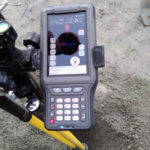
SurPad

Android – Field Data Collection Software
SurPad is a GNSS surveying and mapping software, designed based on years of accumulated market experiences, combining them with the international mainstream of surveying and mapping data acquisition functions. With powerful functionality, Surpad brings integrated RTK control, GIS data collection, road design and layout into one place. This software has outstanding graphic interaction, powerful functions and is very intuitive.
OVERVIEW
- 1. Step by step guide, easy for configuration
- 2. Powerful CAD function
- 3. Convenient stakeout function
- 4. Supports multiple data formats
- 5. Share data with QR code easily
- 6. Supports multiple languages
- Description
Description
SPECIFICATIONS


